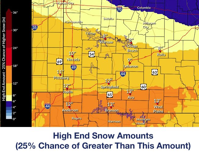
The National Weather Service has issued their latest information packet regarding the expectations of the incoming winter storm likely to hit Friday night.
Update: 1:45pm
A new information packet has been released, expanding the previous forecast range and intensity of the coming weather to encompass sections further north than initially predicted. See below for more:
01.21.2026 1.40 PM CST - DssPacket(Original Release)
A winter storm watch is currently in effect for much of the listening area, with highest chances for accumulation of snowfall falling along the Arkansas border, meaning Ozark, Howell, and Oregon County.
While exact impacts can’t be exactly predicted at this time, bitter cold temperatures are an inevitability, meaning area residents should prepare accordingly for potentially sub-zero wind temperatures.
01.21.2026 6.05 AM CST - DssPacketKyle Perez, meteorologst with the National Weather Service gives us a synopsis:


