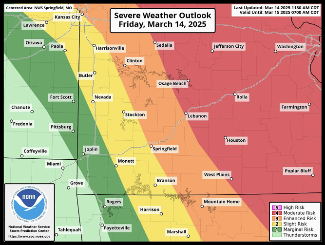
Previous projections on when and where the evening’s storms will develop has changed, with the overall line of 4/5 severity moving westward. The expected time frame for most of the listening area sits between 6pm to 10pm.
The National Weather Service in Springfield now says that West Plains has been included in the threat range, and there is a potential of up to baseball-sized hail.
Advertisement
Chances of tornadic activity have also risen, up to 15-29%. The full informational packet has been posted below.
DssPacket


