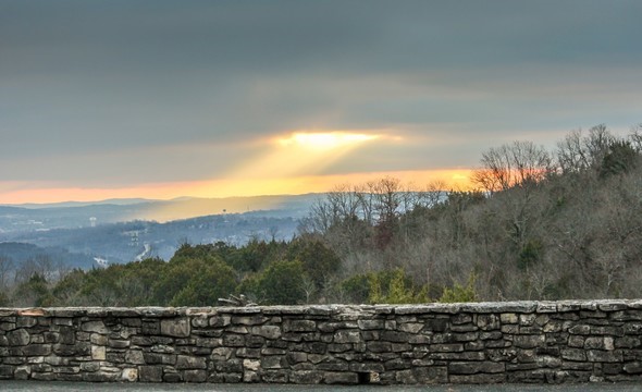
Some conservation areas offer great vistas of surrounding countryside.
In addition to great hunting, fishing and nature-viewing opportunities, the landscape of some Missouri Department of Conservation (MDC) areas offer another opportunity – scenic views.
Enjoying beautiful outdoors scenery might not be as far away as you think. Postcards and travel books often give the impression that breath-taking landscapes can only be found at high mountains and deep canyons located far from the Show-Me State. However, the up-and-down topography of some MDC areas in southern Missouri offer opportunities for people who want to photograph scenic landscapes or for those who simply want to enjoy a beautiful view.
“Don’t dismiss locations just because they are close by,” said award-winning MDC photographer Noppadol Paothong. “When it comes to scenic views, people are always thinking exotic locations, but they don’t think about the locations that are nearby.”
Here are some examples of MDC areas in southern Missouri that feature great views:
Ruth and Paul Henning Conservation Area, Taney County: The east-facing parking lot just off Hwy. 376 sets higher than the surrounding countryside and offers good potential for sunrise photographs and a great view of the landscape. The 1,534-acre Henning Area also has a 40-foot tower atop Dewey Bald that provides a good view of the surrounding White River Hills and an observation deck on the Glade Trail. A description and map of the Henning Area can be found here:
https://nature.mdc.mo.gov/discover-nature/places/ruth-and-paul-henning-conservation-area
Preston Flats, Caney Mountain Conservation Area, Ozark County: Several highlights can be found at the 7,899-acre Caney Mountain Conservation Area but in terms of scenic views, three locations atop Preston Flats Ridge (elevation 1,490 feet) on the west side of the area are hard to beat. All three spots are marked by “scenic vista” signs. One vista features a view that stretches all the way to Arkansas. These vistas can be accessed via the Center Trail, which begins at the area headquarters located on Caney Mountain Refuge Turn off Hwy. 181, six miles north of Gainesville. A description and map of the Caney Mountain Conservation Area can be found here:
https://nature.mdc.mo.gov/discover-nature/places/caney-mountain-conservation-area
Stegall Mountain at Peck Ranch Conservation Area, Shannon County: This peak is part of the 5,387-acre MDC-managed Stegall Mountain Natural Area, which sits within the 23,049-acre Peck Ranch Conservation Area. This high point (elevation 1,348 feet) offers scenic views of the rugged Ozarks landscape that surrounds it. Once you’ve seen the far-away landscapes atop Stegall, visitors to this area will also want to take a close-up view of Stegall’s rhyolite glade. Among the glade’s sparkling pinkish rhyolite outcroppings will be wildflowers, insects and wildlife found upon glade habitats. Here are directions: From the junction of Highway 19 and Highway H in Winona, travel east 5 miles on Highway H to the Peck Ranch entrance sign, then turn right (east). Once you’re in the area, turn left (north) onto a gravel road that goes for 1.5 miles through the natural area and ends in a parking lot. From the parking lot you can hike up “Tower Road,” (so-named because of the old fire tower that still can be found on the hilltop). Another option: Instead of turning left once you’re within the Peck Ranch Area, continue straight until you reach the Ozark Trail Parking lot. From there, hike the Ozark Trail north into the Stegall Mountain Natural Area. This is a more rugged hike but also offers great viewing opportunities. A description of the Peck Ranch Area and a map that includes ways to get to the Stegall Mountain Area can be found here:
https://nature.mdc.mo.gov/discover-nature/places/peck-ranch-conservation-area
Cedar Gap Conservation Area, Wright County: The trail that winds through this 431-acre area features an overlook that, among other scenery, provides a beautiful view of the headwaters of Bryant Creek. Cedar Gap is located just east of the Webster County/Wright County line and just south of U.S. Highway 60. A description and map of the Cedar Gap Area can be found here:
https://nature.mdc.mo.gov/discover-nature/places/cedar-gap-conservation-area
Wah’Kon-Tah Prairie, Cedar and St. Clair counties: Though this prairie (management duties are shared by MDC and The Nature Conservancy) features no high peaks or deep hollows, don’t sell the flatter lands short. This 3,350-acre area near El Dorado Springs offers a remnant snapshot Missouri’s tallgrass prairie – a habitat that once covered one-third of the state. Some spots on the area’s rolling hills offer sweeping views of native grasslands which, in summer, are dotted with brightly colored native wildlflowers. A description and map of Wah’Kon-Tah Prairie can be found here:
https://nature.mdc.mo.gov/discover-nature/places/wahkon-tah-prairie
Regardless of what type of landscape they’re at, Paothong has these additional tips for people trying to improve their landscape photography skills:
“Look for something that registers in the foreground, something prominent like a tree or a flower. You want to have a balance between the foreground and the background,” he said. “Pay attention to light, too,” he added. “Landscape photography usually looks better in the morning or in the evening.”
Taking multiple trips to the same MDC area is also important for good photographs. Paothong said good photos begin with a good knowledge of the landscape.
“It really helps to know the area, he said. “Know where the sun comes up, where it sets, what flowers you can find there, what are some of its landscape features; knowing those types of things will help you get better photographs at an area.”
Download MDC’s free MO Outdoors app to find MDC areas close by, including driving directions to those areas. You can also find information at mdc.mo.gov.


